Background
“Mapping the Civil War in Arlington” is a digital humanities project that leverages the GPS coordinates of Union regimental camp locations in northern Virginia and the origin points of the volunteer troops. The primary tool for the project is Kepler.gl which permits users to conduct geospatial analysis. “Mapping” tells an interesting story of how young volunteers from all over the north answered the call to save the Union and free the slaves. They traveled hundreds of miles (some over a thousand) from the states and cities where their units were mustered in.
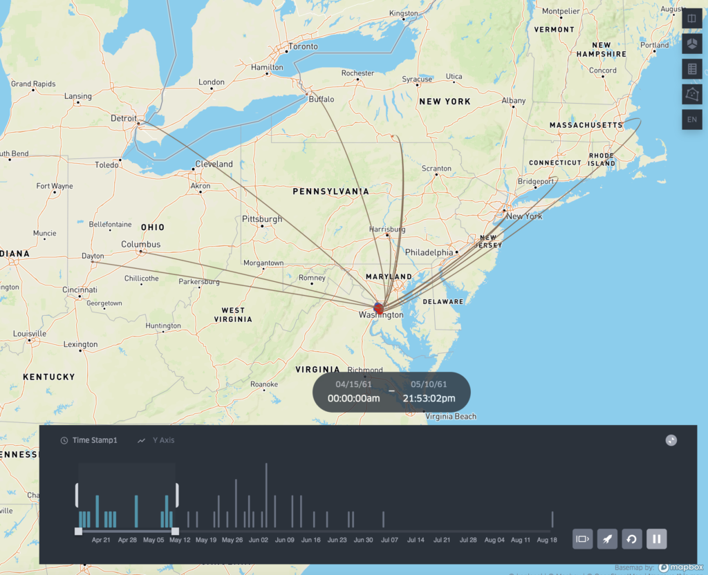
For most of these soldiers it was the first time they took a train or traveled beyond 20 miles from where they were born. Upon their arrival in Northern Virginia it was the first time they entered the south and saw slaves. By linking the camp locations with the regimental origin points an perspective emerges as to how northern states responded to the early crisis of the war.
Data and Other Sources
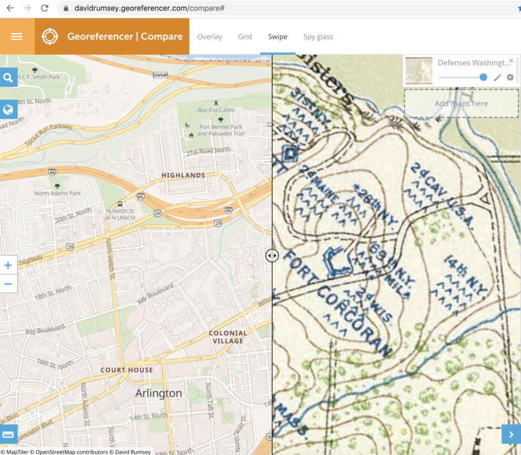
The primary source of data for the project were two almost 160 year old maps created early in the war. One map is called the “Sketch of the Seat of War” and the other is the “Map of the Ground Occupation and Defense of the Division of the U.S. Army in Virginia 1861”. Both maps captured the exact locations of over 50 regimental camps. Using these historic maps along with Georeferencer tool provided by the David Rumsey Historical Map Collection it was possible to compare the camp locations with modern reference points.
Another key source for the project is the website The Civil War in the East which provided the city, and state information for the identified regiments. Once these sites were located another resource was used (Latlong.net) to capture their general latitude and longitude coordinates.
Project Goal
The goal of “Mapping the Civil War in Arlington” is to provide an educational resource for three primary audiences. These include:
1) fourth grade teachers and students in Arlington County, 2) Civil War historians, and 3) local neighborhood associations. In the state of Virginia, the topic of the Civil War is introduced to elementary students in the 4th grade. “Mapping the Civil War” brings history closer to home for these students. Plotting the locations of Union regimental camps on a modern map using applications like Keppler.gl, will help students to literally discover the history in their backyards. Teachers will be able to use the GIS data to create visual timelines and track how the Union army grew in size.
For Civil War historians, “Mapping the Civil War” makes accessible a new collection of data that focuses on a relatively unknown historical period. From May to October 1861, Arlington was the front line between Union and Confederate forces. A comprehensive overview of the location of the regimental camps, forts, and military engagements provides a different narrative. These northern regiments, were untested, poorly trained, and experiencing the south for the first time. Many of the Union Army’s future military heroes, like William Tecumseh Sherman, were still not battle tested.
Finally, neighborhood associations in Arlington are very active in historic preservation. “Mapping the Civil War” provides these associations with a new historic perspective. Residents will be able to look online and see who camped in their backyards.