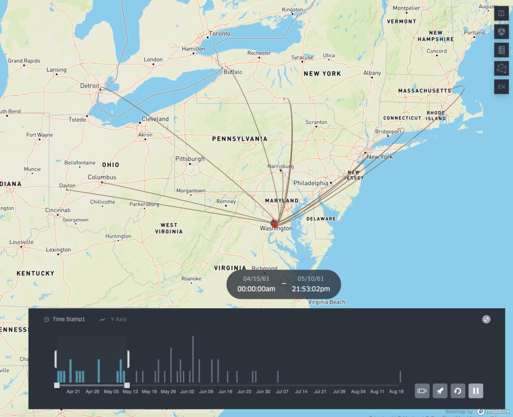
“Mapping the Civil War in Arlington” is the final project for my Introduction to Digital Humanities course at George Mason University. “Mapping” tells an interesting story of how young volunteers from all over the north answered the call to save the Union and free the slaves in 1861. They traveled hundreds of miles (some over a thousand) from northern states and cities to camps located in Arlington, Virginia to defend the Capital. The project is a prototype of how to use historical maps to identify GPS coordinates on a modern map.
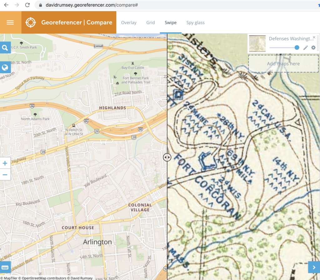
The primary resource used for the project is Kepler.gl. A powerful open source geospatial analysis tool for large-scale data sets. The primary data source were the longitude and latitude points identified by researching historic maps from the Civil War. I was able to leverage another resource provided by the David Rumsey Map Collection, called the “Georeferencer”.

The key to the project was the discovery of two 160 year old maps created early in the war. One map is called the “Sketch of the Seat of War” and the other is the “Map of the Ground Occupation and Defense of the Division of the U.S. Army in Virginia 1861”. Both maps captured the locations of over 50 regimental camps in Arlington during 1861. Once the regiments were identified it was then easy to research their individual histories and discover what city or state they came from.
As the project proceeded I realized that the data was bringing to life an interesting and relatively unknown relationship between Arlington and the cities and states of the north during the early part of the war. The timeline feature of Kepler provided an opportunity to display in a dynamic way when and where the regiments were mustered in and when and where they eventually camped in Arlington. As a prototype, I was aware that the projected needed to be scoped so that it demonstrated a capability, but did not get too bogged down in details. Kepler proved to be a valuable resource, but I would eventually like to do more with the individual endpoints and provide more interactivity, such as links to the regimental histories, the cities they came from, and individual soldier stories.
The primary goal of the project was to provide local historians and elementary school teachers/students a resource to discover and learn more about Arlington’s role in the Civil War. During the peer review process I was provided some very useful feedback to improve the project by linking the project site to the Arlington Historical Society. Their recommendation provided an opportunity to actually employ the social media communication plan we learned about doing in class. In addition, I created a list of academic competency questions that teachers and students could use to better understand how to use the maps and data provided.
Finally, the project provides a new perspective about using old resources. By employing Kepler.gl, “Mapping” provides a way to make something as static as a map, very dynamic. The final project exceeded my expectations because it visualizes a very compelling story about how Arlington in 1861 was at the epicenter of the Civil War. Overnight, tens of thousands of Union troops arrived from cities all over the north. These inexperienced, volunteer troops, were still untested and the horrors of the war were still waiting ahead. For most of these soldiers it was the first time they took a train or traveled beyond 20 miles from where they were born. Upon their arrival in Northern Virginia it was the first time they entered the south and saw slaves. By linking the camp locations with the regimental origin points a previously unknown part of Civil War history is emerging. A history that Arlington can now claim as its own.