I am pleased to report that there has been much progress in starting the “Mapping the Civil War in Arlington” project. The basic site theme and layout has been worked out. Also I have started populating dozens of items in the hosted Omeka platform. I think the first challenge that needed to be overcome was understanding the item, collection, exhibit hierarchy that Omeka provides inside the box. Then ensuring that item definitions, and collection descriptions were logical. Finally, the were the need to conceptualize how exhibits were going to be developed.
At this point in the project, a persistent problem is inputing the metadata and tags. There is a reason that this type of work is specialized. Since I consider myself a forest type of person, working on the individual trees seems tedious and laborious. Building this collection right, will take some time and some other sets of eyes.
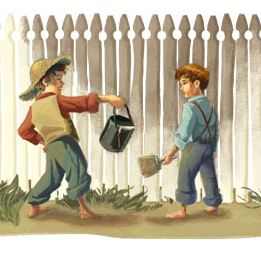
For this reason, I also want to include a contribution feature to encourage other people to upload files and the associated metadata. I would compare this to Tom Sawyer encouraging other boys to paint the fence. It is my understanding that Omeka has a plugin that supports this feature. I am seeking some assistance to help me set this up.
One bright spot so far is the “mapping feature” that Omeka provides. Since the title of my project includes the word mapping, having the ability to place an identifier on a map to locate a geographic reference to an item is pretty cool. I think for students this will be a popular feature, especially if they want to see if anything happened in Arlington near where they live.
For next week I am going to spend time on better defining tags and collections. Also, I am planning on creating specialized pages for resources, videos, and lesson plans. I realize that the collection or curating process is reiterative and it is necessary to revisit and constantly add information as necessary.
Finally, it did not take too long to get familiar with the Omeka platform. The basic functionality and navigation are well thought out. I’m glad to see that you can add additional themes, and someday, if my grant is awarded, hire a graphic designer to create my own custom theme. Words of advise to those that will someday have to do a similar project. Imitation is the sincerest form of flattery. Do your homework and review collection sites that work well. This will make all the difference in feeling confident to proceed.
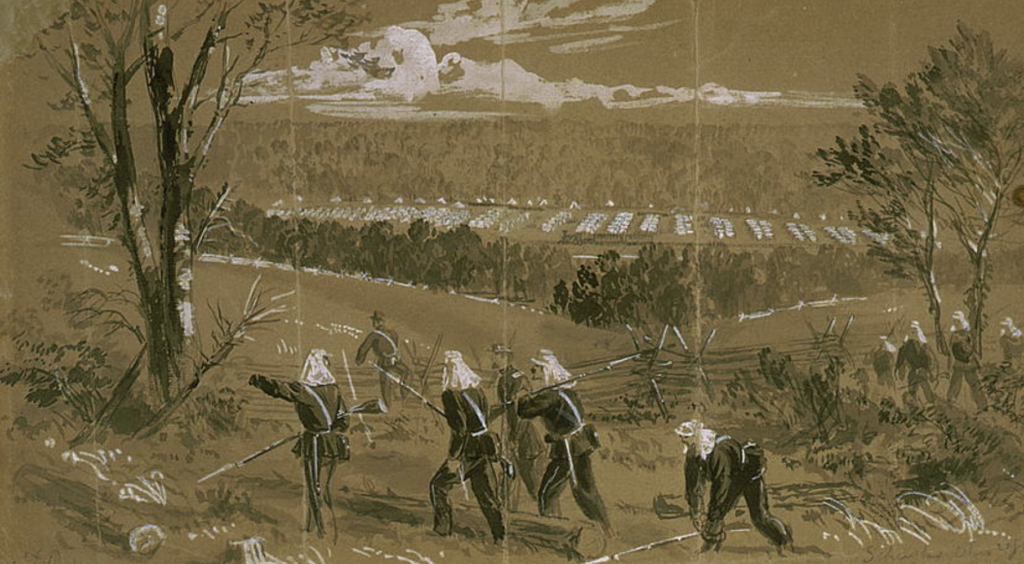
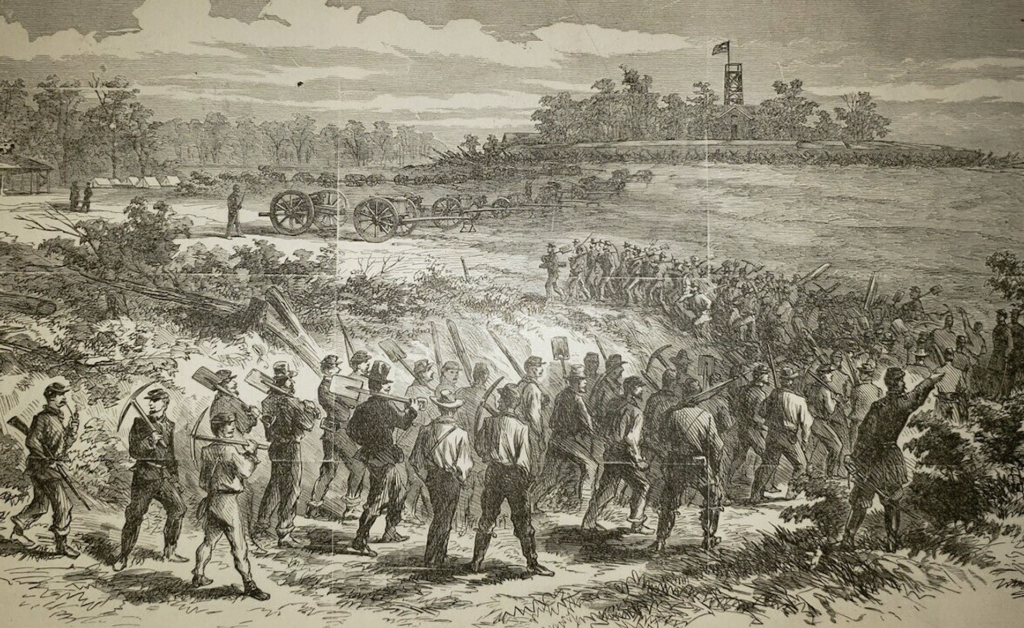
7th Ohio Regiment Scouts on Upton’s Hill, Virginia June 17, 1861. Artist – Alfred Waud
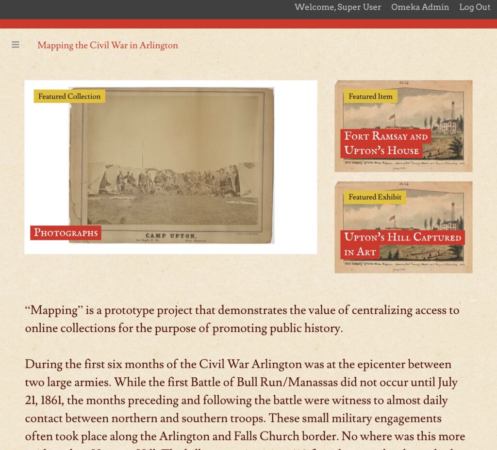
Mapping the Civil War in Arlington: Upton’s Hill, is an Online Media Collection Project (OMCP) that will provide local historians, researchers, and students, access to primary sources from the Civil War. These primary sources will include photographs, drawings, maps, letters, public records, as well as historic newspaper articles related to Arlington. In addition, there will be photographs of Civil War artifacts, and links to other media collections.
The OMCP will centralize access to disparate archives and collections of Arlington related Civil War records, using a popular digital collection management platform called “Omeka.” The availability and accessibility of these Civil War era primary sources will promote a larger and more collaborative interpretation of Arlington’s role during the conflict. The project will also encourage new research and discoveries that will highlight the social, political, and cultural history of the people living in Arlington. “Mapping” will also document the stories of Confederate and Union regiments, as well as those of individual soldiers that came from all over the country to fight and die in Arlington.
The Online Media Collection Project will be developed in several phases. These include:
Prototype development phase, using the Omeka application and only targeting the local history of Arlington’s “Upton’s Hill.”
Buildout Phase, recruiting local historian support and volunteers to help with inputting and building out the site.
Evaluation phase, conducting site usability studies and capturing feedback
Going public with the OMCP
Historical Context:
“Mapping” is a prototype project that demonstrates the value of centralizing access to online collections for the purpose of promoting public history. During the first six months of the Civil War Arlington was at the epicenter between two large armies. While the first Battle of Bull Run/Manassas did not occur until July 21, 1861, the months preceding and following the battle were witness to almost daily contact between northern and southern troops. These small military engagements often took place along the Arlington and Falls Church border. No where was this more evident than Upton’s Hill. The hill’s summit, rising 410 feet about sea level, and overlooks, Arlington, Fairfax, Falls Church, and Washington, D.C. Its strategic location made it an important military objective. During the war dozens of regiments from both sides camped there, and eventually the Union Army built a fort there.
160 years later, Arlington County residents know very little about the Civil War, and even less about Upton’s hill’s local history. Overshadowed by the major battles that were to take place in 1862 and beyond, the military conflict in Arlington is a forgotten period of US history that is worthy of retrospect. The major combatants of both sides, including William T. Sherman, George B. McClellan, James Longstreet, and Jeb Stuart all lived and fought in and around Arlington in 1861. For a brief period of time the Confederates seriously considered invading Arlington. While Arlington’s Historical Society has published a few articles about Civil War, the scope and scale of what occurred on Upton’s Hill during the war remains unknown. However, this is dramatically changing due to the fact that the Civil War was well documented and photographed. As a result, there is a wide availability of digital collections that provide access to primary source material. These collections, including letters, diaries, drawings, regimental histories, and photographs, include many records associated with Upton’s Hill. These collections are helping local historians “rediscover” Arlington’s Civil War history. Not surprisingly, the introduction of these “new” primary resources, is somewhat disruptive, and challenging the status quo of decades old scholarship.
The initial focus of the prototype project will be on the Union regimental camps located on Upton’s Hill. Some of the project’s historical questions will include:
What do the collection’s primary sources reveal about how these soldiers lived, and what was their war experiences?
What was the impact of the war on local residents? How did they react?
What new local historical interpretations can be discovered?
An expanded project would include more geospatial details of fort locations, local military engagements, and other topographical features, like bridges, hills, and roads. Finally, the project also has the potential to personalize the war by permitting researchers and students to identify individual units and soldiers and track their real-life stories.
Digital Technologies
The Online Media Collection Project will leverage the Omeka application as its web publishing platform for sharing the project’s digital collections and exhibits. One of the goals of this project is to demonstrate the viability and sustainability of developing an online collection. Omeka provides the flexibility to start small, with the focus only on Upton’s Hill. But the platform can scale later on to include a wider and more in-depth collection of Arlington’s local Civil War history. An initial challenge will be developing an information hierarchy that reflects the available primary source material, and how to present it in a user-friendly way. The built-in themes and interfaces provided by Omeka will provide some assistance in establishing this framework.
The OMCP should promote historic research collaboration by providing the means for the site’s users to publish primary source recommendations, questions, and comments. This will help in the discovery phase. The project will encourage engagement and scholarly discussion regarding collection items, their authenticity, and applicability. Omeka has some additional plug-ins that may need to be added later on in order to provide this capability.
Audiences
April 12th, 2021 is the 160th anniversary of the start of the Civil War. As a result, there is going to be a renewed interest in the Civil War and local history in Arlington. The project will be designed for several key personas. These include local historians, teachers, students, and history buffs. The primary audience will be on local historians. The secondary audience will be for teachers. In regard to local historians, the site is intended to become an important source of validating historical authenticity and presenting new discoveries. It will provide a venue for sharing knowledge and collection sources. For teachers, the site will include lesson plans and activities targeted for Arlington students. These activities will promote local history and discovery of important Civil War sites, including Upton’s Hill.
Finally, the project will attract a lot of attention from Civil War history buffs. Stories about Arlington and the war will be new to many in this audience. However, since during the Civil War regiments from over 15 states camped in the county, there may be a greater national interest. One benefit of seeking a wider audience is the potential for new and undiscovered primary sources. These history buffs could be the “wisdom of the crowd” and their engagement could fill in some missing historical references and add to new interpretations.
As part of my collections project I had to develop two personas. These personas are intended to keep me focused on who the project is intended for and how will they determine if it is successful or not. Using personas are very helpful and their application goes beyond just digital projects. As a disclaimer these personas are not intended to represent any one in real life, but they are certainly inspired by people I know. As they use to say in the TV show “Dragnet” the names have been changed to protect the innocent.
Persona #1
Name: Jim Thurber Demographic: 55-75, White male, retired Descriptive Title: Member of the local historical society End Goals: Jim is aware of social media and online collections and recognizes that his local historical society has not kept up with these technologies. He also would like to widen the society’s demographics, and bring more younger people into the organization. Jim also knows that his society is rooted in a dated approach to local history. This has impacted its interpretation of Civil War history. In the past the society has advocated support for the creation of an onsite museum, located at small elementary school. However, the impact of COVID now demonstrates the greater need to make local history accessible online, so the wider community can participate in its curation and interpretation. Quote: “History needs to be a shared experience and everyone should be able to participate in its interpretation.” A Day in a Life Narrative: Jim is very active with the local history society. As a member of the its board for many years, he is concerned that the society is losing its relevance as a recognized advocate for historical curation and preservation. He has a strong track record in promoting local history and is well known among civic associations and local government. Since he is retired he can spend a lot of time researching and promoting preservation projects. He has a strong interest in local Civil War history.
Persona #2
Name: Yolanda Smith Demographic: 30 -45, African American, female Descriptive Title: 4th grade elementary school teacher Quote: “I want to make history more exciting for my students.” A Day in a Life Narrative: As a 4th grade teacher in Virginia the Civil War is an important part of the state’s history curriculum. It is difficult to make something that happened over 160 years ago relevant to a 10 year old. Being able to offer class assignments based on local history would be of great value. End Goals: Ms. Smith wants to be able to direct her students to online resources that support interesting and innovative activities. She wants to teach my students the difference between primary and secondary sources, and how to develop their own skills for historical interpretation. Many historical documents, like letters and diaries, are still in cursive. She needs help in decoding them. Some of the concepts of the Civil War are difficult to teach in today’s politically charged environment. Ms. Smith is looking for county supported programs that provide new and local interpretations of black history and freeing the enslaved. She would love to have her students participate in the local historic research and curation process.
In the past, historians would spend a significant amount of time researching and uncovering new facts and sources of information. This academic approach required a laborious process to document their findings. Then they needed to find an appropriate venue to present or publish their interpretations in order to reach an audience. Today, social media has completely changed this paradigm. According to the Pew Research Center’s report entitled Three Technology Revolutions, “The new reality is that as people create social networks in technology spaces, those networks are often bigger and more diverse than in the past.” As a result historians are able to engage with new and more diverse audiences. At the same time these audience are able to dialogue and provide immediate feedback.
In his article, Creating a Dialogic Museum, John Kuo Weitchen asks “what roles should historians, and other professional specialists, play in this dialogue?” He observes that many historical organizations believe that they have a greater authority to “produce interpretations of the history and culture of a community than members of the community itself.” In essence authorship becomes more important than knowledge transfer. But Weitchen believes that this authority should be a shared and collaborative process. A process that social media is helping to facilitate.
Social media is allowing audiences to become a critical part of the historical curation and interpretation process. This is most evident in public history projects. For example, in Building Histories of the National Mall, a project created by the Roy Rosenzweig Center for History and New Media, developers carefully integrated their content strategy with its social media strategy. Great care was given to limit the social media platforms utilized, but also to standardize the presentation of content as much as possible.
The popularity of social media and online technologies are also having an impact on traditional gate keepers like historical societies and local historians. According to Ronald Grele in his well known paper, Whose Public? Whose History? What is the Goal of a Public Historian?, the local history movement in the 1960s, including professional and amateurs, created one of the largest public audiences in the United States of its time. However, local historians and historical societies are struggling to keep up with the next wave of independent and non-affiliated public historians. Grele writes that “every man can become his own historian; that relatively ordinary people can seek and find knowledge of the world.” Grele goes on to say that the task of the public historian should be to “help members of the public do their own history and to aid them in understanding their role in shaping and interpreting event.”
So what should be the relationship between public historians and their audiences? Maybe Sam Wineburg, in his article, Thinking Like a Historian, has it right. He says that historians “see themselves as detectives searching for evidence among primary sources to a mystery that can never be completely solved.” But as detectives historians have developed an approach to “historical thinking” by establishing criteria to evaluating primary sources. Do historians have a responsibility to share this approach with their audiences? Wineburg believes so and he provides the following list to help:
Sourcing
Contextualization
Close reading
Using background knowledge
Reading the silences
Corroborating
So why should public historians encourage their audiences to “think like historians?” In the social media world arguing is more often the goal, rather than a means to an end. As a result, historical facts get lost in the dialogue. Online everyone can have an opinion or their own interpretation of history. Wineburg believes that while everyone is entitled to an opinion, “not every opinion deserves to be believed.” To be persuasive, an opinion needs to backed up by evidence. Curating and interpreting this evidence will continue to be an important part of the relationship between audiences and public historians.
Fortifications and Observatory at Upton’s Hill – Arlington, Virginia 1861
At a public forum regarding the Civil War in Arlington, a local historian claimed that nothing of “importance” happened at a particular location. A location that is being considered for a major preservation project. It was a simple statement. Since this person is considered an expert on local history his “interpretation” carries some weight with the Arlington community. However, it was obvious that his observation was not based on fact, but rather a lack of awareness or acceptance of a growing body of new evidence. A body of evidence that includes publicly accessible primary source documentation that actually refutes his claim.
This episode made me think about public history and the role of local historians. It especially made me go back and review Ronald Grele’s article, “Whose Public? Whose History? What is the Goal of a Public Historian? (1981). Now over 40 years old, Grele’s work still provides one of the best descriptions of “public history.” He lays out a strong frame work for understanding the evolution of historians, from their academic origins, to local historians, and public historians. What he was not able to foresee, was the next evolution, where audiences can now participate in the interpretation process. Something that I would define as “social history” or social media history.
Social media offers a new way for historians to engage with their audiences, whether it be primary or secondary. Public history is no longer limited by small, in person venues, like a class room or library. Instead public historians can reach thousands in an instant. Nor do authors have to wait years to publish their work. The internet and social media is dramatically changing our concept of public history.
For my project “Mapping the Civil War in Arlington” I conducted research on my intended primary and secondary audiences. My first interview was with Tom Dickinson, a member of the board for the Arlington Historical Society (AHS). Since the mid 1950s the AHS has been a significant force in shaping, and defining Arlington history. It has been publishing an annual magazine that provides a venue for local historians to present their research and findings. Members of the AHS would be a primary audience. They would be interested in learning more about Civil War history and how it is related to Arlington. The project would also benefit from AHS members and other local historians contributing and confirming historical accounts and sources.
Mapping the Civil War may be considered disruptive to some primary audiences, since it challenges long held beliefs within the AHS that nothing of military significance happened in Arlington county. While AHS has published several articles about small skirmishes, and the impact of northern troops occupying the county, there never was a wider interpretation of the role Arlington played in the Union victory. Arlington’s Civil War history has long been overshadowed by Southern General Robert E. Lee and the “Lost Cause” narrative that portrays him and other Confederate leaders as noble but conflict figures. In fact for decades, the county’s logo is a representation of Arlington House, Lee’s former home. Last year the county government announced that it was going to change the logo, as well as continue to review school and street names that honor Confederate leaders.
My second interview was with a Civil War history buff and living history reenactor. He just happened to be my brother Tom Vaselopulos. Tom lives in Lexington, Kentucky, and represents a wider and potential secondary audience of history enthusiasts who conduct online research. In my brother’s case, specific his interest is in the history of the 79th New York Volunteers, or better known as the “Highlanders.” His reenactment group portrays this particular unit that was made up of Scottish immigrants from New York City. The 79th New York were part of the first wave of Union troops that arrived in Arlington early in the war. They helped build Fort Corcoran which was located in Rosslyn overlooking the Potomac river.
Mapping the Civil War will attract a lot of interest from secondary audiences since it will provide online access to a wide collection of Union and Confederate regimental histories. Tom and other Civil War buffs would be very interested in learning more about the role of individual regiments and their experiences in Arlington. These histories will also support and provide irrefutable evidence of the wider scope of local military activities in Arlington. For example, elementary students will be able to learn about what happened in their own backyards. One of the project’s goal is to allow audiences to participate and contribute to the collection process. Civil War records are quite extensive. It will require a significant amount of collaboration/co-creation, between audiences and participating local historians, to map this history. People of all ages and backgrounds would be able to participate.
In regard to the impact of the audience research on my project, I would like to quote from Ronald Grele’s article.
“The current growth of public history and the debate over the definition of the historical profession has taken place within the context of an ironic situation. The study of history is in almost total collapse in the academy, while the popularity of history with the public is growing everywhere”.
In order for Mapping the Civil War to succeed, it has to provide the means for a wide range of participation and engagement to ensure that the historical collection and interpretation process is objective. This means that the goals of “Mapping” should not be to narrowly define the historical interpretation at the start of the project. Rather the goal should be to strive for transparency. In order to minimize subjectivity, the project needs to establish well-defined and agreed upon criteria that will determine and rank the historic value of the intended collection records. This ranking process will be dynamic and leverage social media to permit audiences to comment and post their preferences.
As Grele observed, the popularity of history is growing. Advances in social media and online collection technologies are evolving. As a result we are witnessing the emergence of the next generation of “historians.” For communities like Arlington, history may be local, but it is also impacted by broader audiences who are interested and may want to contribute. Mapping the Civil War can benefit from the “wisdom” of this crowd and these new social historians.
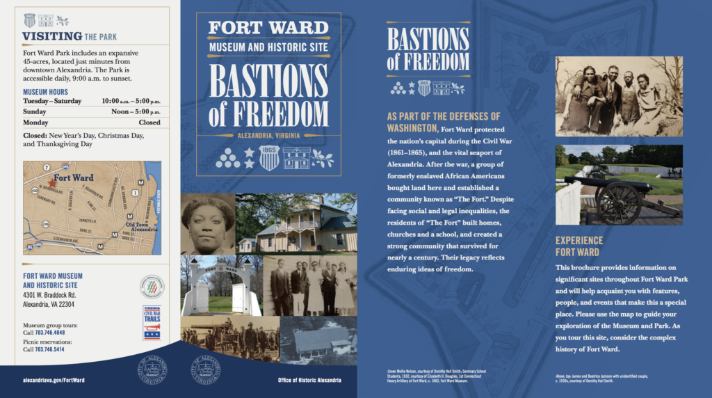
For a class assignment I had to select a public history site to visit that also has an online presence. I chose the Fort Ward Museum and Historic Site in Alexandria, Virginia.
Physical Site:
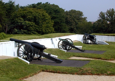
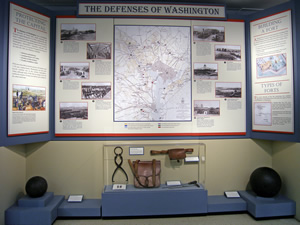
Fort Ward offers visitors an opportunity to experience a Civil War fortification similar to the dozens that once surrounded Washington D.C. from 1861-1865. The outside exhibits of the fort, include canons, a replica of the fort’s gateway, and a officer hut. The site also includes a small historical museum. Fort Ward tells the story of the Union troops that were rushed into Northern Virginia to defend the Capital early in the war.
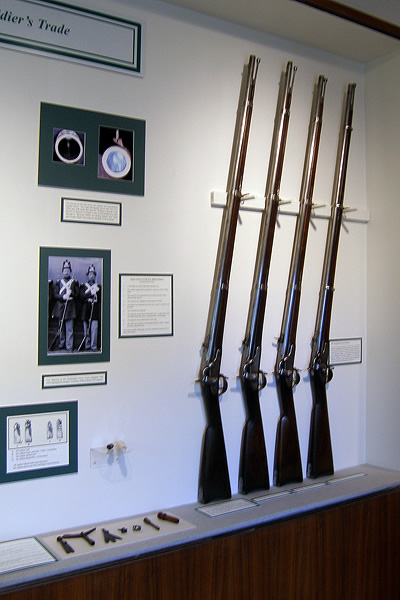
Display of Civil War era muskets
According to the museum’s website the permanent collection is diverse, with over 2,000 holdings that include: military equipment related to the infantry, artillery, cavalry and navy; edged and shoulder weapons; flags; musical instruments; medical equipment; uniforms and clothing accessories; cooking and mess equipment; artwork, primarily period prints of both Union and Confederate significance; documents; photographs; and artifacts excavated at Fort Ward.
Display of the forts around Washington
The museum is a time capsule of local history. Curators take full advantage of the small two story building, utilizing traditional glass cases, wall displays, and large textual presentations. The first floor, where all of the displays are contained, is small rectangular one room open space. In the center is a two sided central wall with displays as well as displays on the perimeter walls. Visitors are able to walk around the center wall and can take their time to stop and see all the displays. In addition to the displays there is a gift shop and a reference library on the second floor. There are no interactive displays, but there is one monitor and that provides visitors with an informative video of the fort’s history.
The museum is successful in its interpretation of a unique part of Civil War history. As the fifth largest fort in the Union Army’s formidable defense system, Fort Ward was considered to be a model of military design and engineering for the time period. The historic site offers education and interpretive programs, and living history activities throughout the year. Fort Ward also interprets Alexandria, Virginia as an occupied city, the city’s role as a vital Union Army crossroads, life within the Defenses of Washington, and the everyday life of Civil War soldiers and civilians. The site’s open space and museum is a favorite with families, history buffs, and Civil War reenactors.
New brochure reflects a transition in historical interpretation
A new brochure available on Fort Ward’s website reflects a recent transition in the site’s historical interpretation. The history of the fort is now expanding to the post war experience of African Americans. After the Civil War the fort was abandoned and the land surrounding it was sold to many African American families. However, during the preservation efforts to save the fort in the 1950s there was need to relocate this 90 year old community. This new story will have an impact on the historical site’s efforts to provide a broader interpretation.
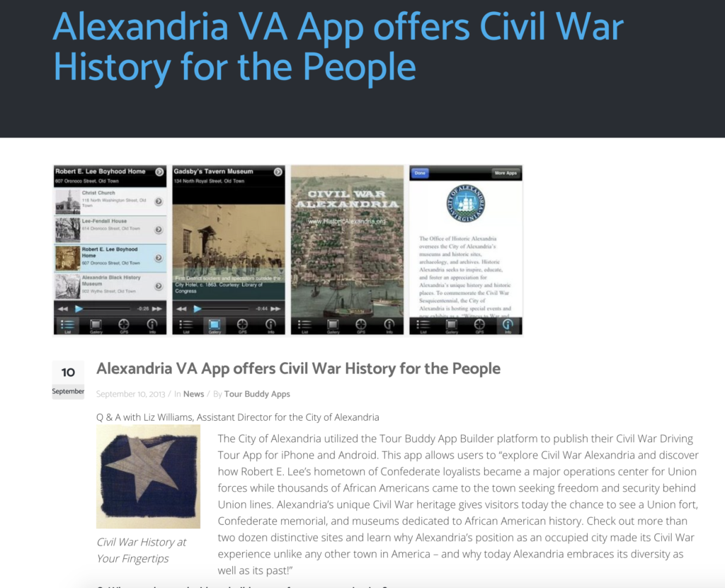
Civil War Mobile App
The City of Alexandria’s main site also offers a mobile application called “Civil War Alexandria”. It lists all of the major historic sites related to the Civil War., including Fort Ward It was introduced for the Civil War Sesquicentennial in 2011. This mobile application is dated and should be refreshed to include more detail for the major attractions for each historic site. This would provide visitors the opportunity to conduct more self-directed activities.
Digital Site:
As a result of the COVID-19 virus, the fort’s museum is currently closed to the public, and its staff are now having to turn towards social media to communicate with existing and potential visitors, as well as calling attention to their collections, exhibitions, and events. This has brought more attention to its online presence.
Fort Ward website
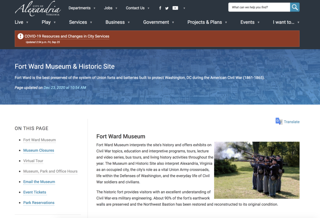
Fort Ward is part of a wider City of Alexandria focus on public history. Because the site is integrated into a higher level website architecture there are some basic problems with navigation and focus. To get to the web pages describing the fort you need to drill down several layers in navigation. https://www.alexandriava.gov/Museums#FortWardMuseumHistoricSite
Also, visitors looking for the museum’s through a search engine will have some confusion when landing on the higher level navigation pages. In addition, the overall site design is constrained by static links, and pages within page links. Despite these usability issues, the site provides a wide array of great historic content and information.
The museum’s site was designed prior to COVID-19 and it does not offer any social media engagement. While it is intended for those interested in history, and visiting the museum, the web pages lack a defined focus for either researchers, educators, and local historians. The site would benefit with more virtual and video components. For example the museum should expand on its efforts to personalize the history of the people associated with the fort and Alexandria. As demonstrated in this recent Christmas video.
Since Fort Ward is such a unique historic experience it should have its own website and social media presence. Online access to content management systems as well as the popularity of social media presents an opportunity for the museum.
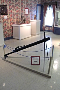
Civil War Rocket Launcher
The current problem facing the museum lies in the effort to make physical collections accessible online and online material accessible at the physical sites. The museum has thousands of items in its collections. But most of these remain hidden and inaccessible to both physical and online visitors. The museum needs to develop a long term strategy to leverage online content management services that will permit many of the items to become more accessible. For example, the physical site should leverage new mobile applications that connect visitors with online content. And the online content should be integrated with the physical collections. There is no longer a need to invest in expensive onsite interactive displays. Let users take advantage of their own devices.
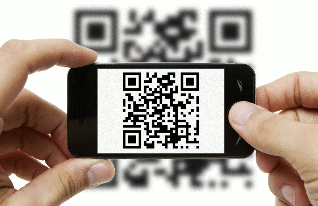
For example the museum can integrate QR scan codes at onsite displays. Visitors using their mobile devices could scan a code that would link to the website’s description of the object or a video.
Another problem is that Fort Ward does not have its own social media branding. Instead it is part of a broader social media strategy with Alexandria government. Leveraging social media enables museums to engage with the public and let visitors expand their experience. The following goals are usually associated with social media strategies.
Sharing News
Brand Recognition
Historic Education
Fundraising
Volunteer Recruitment
Small museums like Fort Ward can use social media to make the curation process more transparent. Followers could watch a video of exhibition designers mapping out the early stages of a new exhibition or an interview with educators and curators on particular subjects. Sharing internal museum processes with the public can be an important driver behind online public engagement.
Recommendations:
A more defined and focused social media strategy could help staff get to know their audience better. This will require:
A review and analysis of Fort Ward’s current online presence.
Evaluation of available media content, and determination of what additional content needs to be created and posted.
Review usage of analytics and reporting metrics.
Review of social media engagement management.
Fort Ward could easily post status updates to Facebook that appear on followers’ news feeds, or create photo albums to show their collections and tag visitors who have attended events. Facebook and other social media provide well-defined analytics that would help Fort Ward gauge their followers’ interests. Analyzing individuals’ public comments, or the number of times a post has been ‘shared’ or ‘liked’ demonstrates a museum’s success at engaging followers via this platform. Finally social media analytics provide demographic breakdowns of visitors who engage online, such as gender and age. This is valuable information for the institution to have because it can tell them who is likely coming to the museum, and more importantly, who is not.
Social Media Content Ideas
Creating and implementing a social media strategy can be difficult. Fort Ward’s staff should experiment with creating “friends of the fort” social media sites on Facebook, LinkedIn, Instagram, etc. Volunteers and staff could post periodically:
Sneak peeks at something the average visitor doesn’t get to see or special events.
Interview a donor about why they support the museum and tell visitors how they can become a supporter.
Introduce museum staff and their contributions.
Feature a product from the gift shop.
Write a post specifically for younger audiences.
Post photos and videos from events while they are underway.
It is clear from this assignment that museums like Fort Ward can no longer see their physical and online sites as separate entities. The popularity of social media is driving the need to integrate the management of both.
Greetings to all of my fellow returning GMU classmates. For those that I have not already met please let me introduce myself. My names is Peter Vaselopulos and I am recently retired from the United States Agency for Global Media/Voice of America, where I was the Deputy Chief Information Officer. I have an MS in Managing Information Systems from GW, and a MA in International Communications from American U. I’m working on this certificate program because I am very interested in Arlington’s Civil War history. I’m currently involved with a historic preservation effort to save one of the few remaining open space properties in Arlington where Union soldiers camped. Check out the link and sign the petition https://www.facebook.com/savefebrey/. I wish I had taken this class before getting involved with the effort. For the moment I’m experiencing Public History in realtime. Looking forward to this class and learning what we could have done differently. One of my goals for the semester is learning more about Omeka. I would like to use it as a repository for Civil War digital records for Arlington’s Historical Society.
“Mapping the Civil War in Arlington” is the final project for my Introduction to Digital Humanities course at George Mason University. “Mapping” tells an interesting story of how young volunteers from all over the north answered the call to save the Union and free the slaves in 1861. They traveled hundreds of miles (some over a thousand) from northern states and cities to camps located in Arlington, Virginia to defend the Capital. The project is a prototype of how to use historical maps to identify GPS coordinates on a modern map.
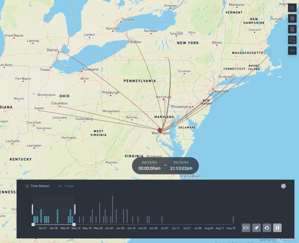
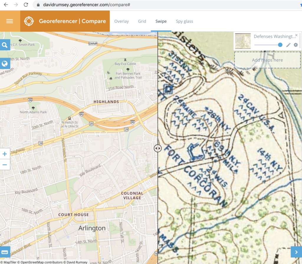
The primary resource used for the project is Kepler.gl. A powerful open source geospatial analysis tool for large-scale data sets. The primary data source were the longitude and latitude points identified by researching historic maps from the Civil War. I was able to leverage another resource provided by the David Rumsey Map Collection, called the “Georeferencer”.
The key to the project was the discovery of two 160 year old maps created early in the war. One map is called the “Sketch of the Seat of War” and the other is the “Map of the Ground Occupation and Defense of the Division of the U.S. Army in Virginia 1861”. Both maps captured the locations of over 50 regimental camps in Arlington during 1861. Once the regiments were identified it was then easy to research their individual histories and discover what city or state they came from.
As the project proceeded I realized that the data was bringing to life an interesting and relatively unknown relationship between Arlington and the cities and states of the north during the early part of the war. The timeline feature of Kepler provided an opportunity to display in a dynamic way when and where the regiments were mustered in and when and where they eventually camped in Arlington. As a prototype, I was aware that the projected needed to be scoped so that it demonstrated a capability, but did not get too bogged down in details. Kepler proved to be a valuable resource, but I would eventually like to do more with the individual endpoints and provide more interactivity, such as links to the regimental histories, the cities they came from, and individual soldier stories.
The primary goal of the project was to provide local historians and elementary school teachers/students a resource to discover and learn more about Arlington’s role in the Civil War. During the peer review process I was provided some very useful feedback to improve the project by linking the project site to the Arlington Historical Society. Their recommendation provided an opportunity to actually employ the social media communication plan we learned about doing in class. In addition, I created a list of academic competency questions that teachers and students could use to better understand how to use the maps and data provided.
Finally, the project provides a new perspective about using old resources. By employing Kepler.gl, “Mapping” provides a way to make something as static as a map, very dynamic. The final project exceeded my expectations because it visualizes a very compelling story about how Arlington in 1861 was at the epicenter of the Civil War. Overnight, tens of thousands of Union troops arrived from cities all over the north. These inexperienced, volunteer troops, were still untested and the horrors of the war were still waiting ahead. For most of these soldiers it was the first time they took a train or traveled beyond 20 miles from where they were born. Upon their arrival in Northern Virginia it was the first time they entered the south and saw slaves. By linking the camp locations with the regimental origin points a previously unknown part of Civil War history is emerging. A history that Arlington can now claim as its own.
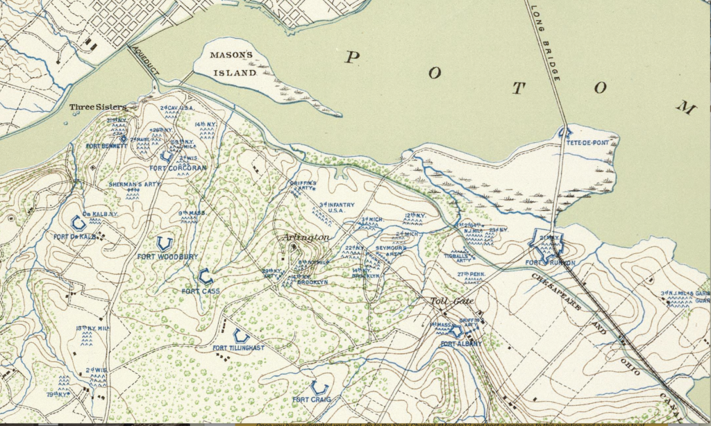
During the first few months of the Civil War, Brigadier General Irvin McDowell ordered a topographical survey of Union forces and defenses in Northern Virginia. The survey led to the creation of a detailed map that shows the locations of forts and regimental camps. Almost 160 years old, the “Map of the Ground Occupation and Defense of the Division of the U.S. Army in Virginia” is a visual reminder of the tens of thousands of Union troops that once occupied Arlington County.
The McDowell survey is part of a broader digital humanities project to use historic maps to plot the location of these forgotten sites on a contemporary and online map. While the location of the forts are well known, the challenge is trying to identify the precise GIS coordinates of the camps. The goal of “Mapping the Civil War in Arlington” is to provide an educational resource for three primary audiences. These include: 1) fourth grade teachers and students in Arlington County, 2) Civil War historians, and 3) local neighborhood associations.
In the state of Virginia, the topic of the Civil War is introduced to elementary students in the 4th grade. “Mapping the Civil War” brings history closer to home for these students. Plotting the locations of Union camps on a modern map using applications like Keppler.gl, will help students to literally discover the history in their backyards. Teachers will be able to use the GIS data to create visual timelines and track how the Union Army grew in size.
For Civil War historians, “Mapping the Civil War” makes accessible a new collection of data that focuses on a relatively unknown historical period. From May to October 1861, Arlington was the front line between Union and Confederate forces. A comprehensive overview of the location of the regimental camps, forts, and military engagements provides a different narrative. These northern regiments, were untested, poorly trained, and experiencing the south for the first time. Many of the Union Army’s future military heroes , like William Tecumseh Sherman, were still not battle tested.
Finally, neighborhood associations in Arlington are very active in historic preservation. “Mapping the Civil War” provides these associations with a new historic perspective. Residents will be able to look online and see who camped in their backyards.
In order to reach teachers, students, historians, and local residents, “Mapping the Civil War” requires a well defined social media strategy. Since the project has a wide audience, it will require the use of several different social media platforms and tools. At the core of the strategy will be the use of a website that will host the online mapping tool. The site will also provide teacher guides and proposed learning activities for students.
The strategy will also include a blog that will provide a location for historians to review update research and engage one an other. The project blog should be updated frequently. In addition, the project should utilize YouTube and Instagram to encourage project contribution by generating “then and now” videos. The goal would be to get students to go visit sites near their elementary school and integrate historic photos with contemporary video.
In regard to the project’s overall message, Civil War history is going through a 21st century revision. As a southern state, Virginia traditionally looked back at the Civil War through a “Lost Cause” filter. But “Mapping the Civil War” provides a new narrative that highlights Arlington’s role in saving the Union, freeing the slaves, and the creation of the Army of the Potomac.
During the first year of the Civil War Arlington was host to tens of thousands of young, inexperienced soldiers from all over the north. These men spent months in Arlington learning how to fight and eventually win the war. Many of the soldiers wrote letters to family back home and kept diaries about their experiences in Arlington and life in the army.
The project networks the digital collections of these first hand accounts with where the soldiers camped. This provides students in Arlington an opportunity to personalize and connect with their local history.
Soldiers of the 23rd New York
Another goal is to engage with a large group of Civil War historians and researchers. This period of Civil War history has often been overlooked. The project is not only about mapping the physical location of the Union regiments, but tracking their activities later in the war. Enabling and leveraging crowdsourcing will shed light on new historical perspectives.
Finally, utilizing Facebook, the project can engage and assist local neighborhood associations with future preservation projects. For example, as part of the “Lost Cause” legacy, many Arlington street names still favor Confederate generals. It would be interesting if the project could encourage and support the renaming of some of these streets with Union officers like General Sherman.
As part of the social media strategy the project will identify some “SMART” goals. These will include specific, measurable, realistic, and time-bound goals. For example, the success of the Facebook strategy will be determined by how many of the neighborhood association sites promote the project. The website and blog statistics will also provide a benchmark for tracking audience growth and an opportunity to respond to comments and questions. The posting of YouTube and Instagram videos and photographs will provide a significant measurement of how well the project is engaging with the local schools. A final measurement of success will be to track and identify other social as well as traditional media responses to the story.
Mark Twain’s Tom Sawyer getting help to whitewash Aunt Polly’s picket fence.
In his book, “The Adventures of Tom Sawyer,” Mark Twain (Samuel Clemens) provides a useful metaphor for crowdsourcing and digitization. Tom turns a boring chore (whitewashing) into something desirable for others to do. What makes the story timeless is that over 144 years later people are still trying to get others to do the work for them. In the realm of digital humanities, transcribing hand written documents or identifying or vectoring shapes, is a tedious and time consuming task. A project with tens of thousands of documents used to take decades to scan, transcribe, and digitize. However, organizations are turning towards crowdsourcing as a way to reduce costs, and speed up the process while creating a community of interest in the project.
People have been participating in crowdsourcing efforts for years without even knowing it. For example, sites that use photo identification or text entry for non-robot identification, leverage the crowd to accomplish some simple digitization tasks. But it is the bigger trend of organizations purposefully creating interfaces to permit the public to contribute to the digitization process that is worthy of review.
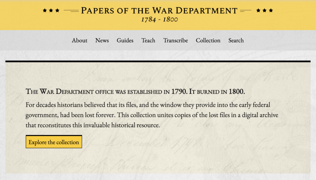
Our crowdsourcing assignment was to review the pros and cons of leveraging public participation in digital collections. It would appear that a growing number of institutions are outsourcing some digitization functions to a public community instead of depending solely on employees. This makes sense considering the sheer drudgery and cost of trying to digitizing large collections. For example, “Papers of the War Department 1784-1800” is a perfect example of how to leverage crowdsourcing to perform correction and transcription contextualization. Currently hosted at the Center for History & New Media at George Mason University, the project’s goal is to restore and make accessible this historic collections of over 42,000 U.S. military records once thought lost in a tragic fire.
Public users accessing the “Papers” site are invited to search, review, and transcribe the remaining hand written documents that need to be digitized. The interface is quite simple and permits users to read a scanned image of the document while attempting to transcribe. In very little time I was able to get familiar with the interface and start transcribing. My only problem had to do with retraining my self to read cursive hand writing from over two hundred years ago.
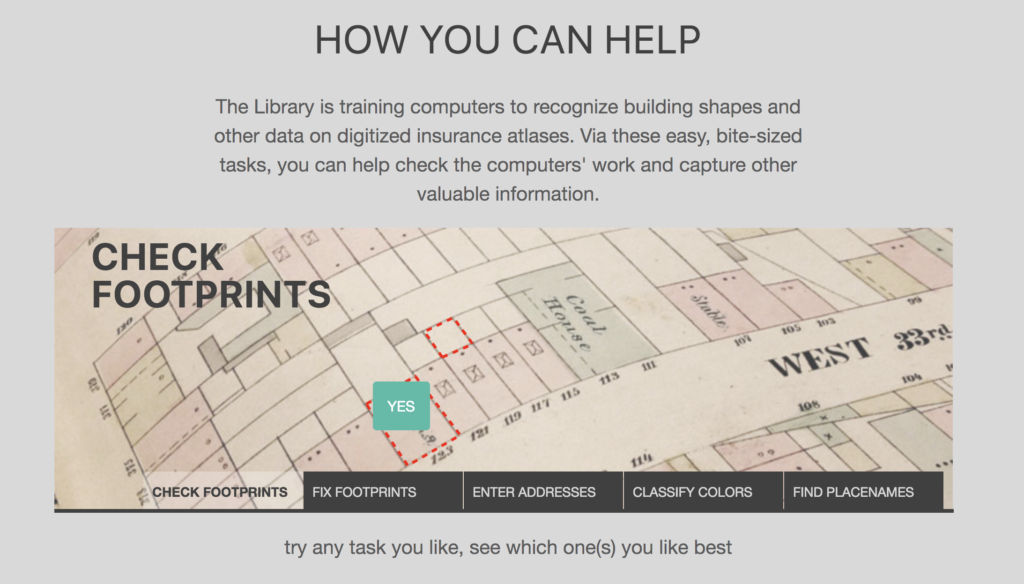
New York Public Library’s Building Inspector site.
Another example of using crowdsourcing is the New York Public Library’s “Building Inspector” site. This project is a little more whimsical and fun. I think Tom Sawyer would not have had such a hard time getting his friends to participate. In an attempt to gain insight from old New York City inspection maps, the Building Inspector site invites users to assist in vectorization or shape discovery of old buildings outlines. In a rather simple, but addictive process, users have only to visualize an outline of a building and determine if it is correct or not, and whether it needs to be fixed. The reason that humans are better than a machine in reviewing the outlines is our ability to quickly determine if it looks right. A rather mindless activity that even elementary students could participate in. It is a good example of how humans can still do the work of a machine if only enough are willing to provide the time necessary to complete the task.
Of the two examples, Building Inspector is probably a better prototype for the future of crowdsourcing digitization projects. Reviewing building outlines is much more suitable for engaging a bigger crowd. Papers of the War Department requires a more scholarly effort. Transcribing is much more intensive work and I would even say a specialty. The site tries to mitigate that problem by offering various degrees of difficulty for the contributor.
It is clear from this assignment that “contributory” projects are here to stay and will only increase in numbers. As online technologies and interfaces improve more of the public will be able to “interact” or access digital and/or physical artifacts provided by institutions (e.g., providing notes on museums’ objects; tagging on galleries’ digital collection). If the interface and tasks or made to be engaging and interesting, the contributors will come back often and the value of the crowdsource will be self evident. However, if the tasks that the participants are asked to perform are too difficult then the number of contributors will be limited. As with Tom Sawyer, it is not enough to just get someone else to do the work. Eventually, they will want to see what is in it for them.